Monday, July 25, 2011

Tien Giang Province, a beautiful and rich area


Area: 2,236sq.km.
Population: 1,668,000 people.
Geography: It borders on Long An Province to the North, Ben Tre Province to the South, Dong Thap Province to the West and the sea to the East.
Administrative units: My Tho City and seven districts including Cai Be, Cai Lay, Tan Phuoc, Chau Thanh, Cho Gao, Go Cong Dong and Go Cong Tay.
Climate: Temperate with the dry and rainy seasons.
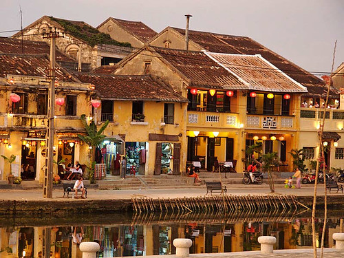
Visitors enjoying Southern specialities and folk songs.

Since the 17th century, the fertile land in the North of the Tien River has been reclaimed and developed by generations of inhabitants into an area with rich rice fields, fruit gardens, and busy trade along the river banks. Gradually, the brisk market towns of My Tho and Go Cong emerged in the fertile Cuu Long (Mekong) River Delta. This area is Tien Giang Province.

Taking a ride for 75km from Ho Chi Minh City along Highway 1A you will arrive at My Tho City, then going further you will visit Cho Gao and Go Cong Districts. Turning to Cai Lay and Cai Be Districts, you will see the My Thuan Bridge spanning the Tien River to Vinh Long Province.

The second biggest cable-stayed bridge across the Tien River to Ben Tre Province replaced the Rach Mieu Ferry. With asphalted roads running to all hamlets and a series of natural and man-made canals, Tien Giang Province has a convenient land and water-way transport system to all communes, districts and other provinces in the Mekong River Delta and to Ho Chi Minh City.

An area abundant in agricultural and aquatic products

Tien Giang Province is a granary. Apart from a stable output of 1.2 million tonnes of rice per year, of which more than 300,000 tonnes are for export, Tien Giang ranks first among the provinces in raising and providing pigs with a herd of more than 500,000 hybrid pigs that yield lean meat.

Each year, the province provides 800,000-plus tonnes of fruits to domestic and foreign markets, ranking first in the output as well as fruit cultivation area (72,500 hectares).

Many farmers specializing in growing mango, mangosteen, rambutan, star-apple, durian and longan trees apply high technology in selecting strains and in farming, which results in bumper harvests.

The names of some fruit-growing areas in the province have become familiar brands, such as Hoa Loc mango (in Cai Be District), Vinh Kim star-apple (in Chau Thanh District), Go Cong cherry, Co Co shaddock, Tan Phuoc pineapple and Cho Gao blue dragon.

Tien Giang Province has many natural fishing grounds that yield high productivity. In recent years, the province has developed the raising of catfish, tiger prawns and other valuable aquatic products.

In Go Cong District, fishermen, who were engaged in fetching oysters on the thick alluvial coast, have raised oysters on 2,000 ha of alluvial grounds that yield high output.

Each year the whole province produces about 120,000 tonnes of aquatic products. Since 1990, the Province’s GDP has increased annually 10% and the export turnover in 2005 is estimated to reach USD 145 million.

An attractive tourist spot

It does not take much time to go from Ho Chi Minh City to Tien Giang Province. Visitors can take a cruise on the large Tien River or take a boat ride steered by a young girl wearing a loose-fitting blouse and a conical hat, through canals shaded by water coconut trees.

They will have a chance to visit fruit gardens and enjoy the tastes of ripened fruit right off the tree. In Thoi Son Island, they will visit villages with orchards where they can taste the local traditional food prepared by villagers and enjoy a traditional opera performance, lovely songs and ditties of Southern Vietnam as well witness the making of local traditional handicrafts.

Going along the Tien River upstream, visitors will visit Cai Be floating market where hundreds of boats and canoes gather to sell and buy the local products.

Along the banks of the river, service shops are always crowded with people. Sometimes there is clear bell ringing from Cai Be Church built in the early 20th century.

This year, Tien Giang Province is expected to receive more than 500,000 domestic visitors and 300,000 foreign tourists.

In the atmosphere of an area criss-crossed with many rivers and canals as well as fruit gardens, they will visit historical relics, temples and pagodas, such as the cultural relic of Oc Eo in Cho Gao District and learn about the history of this area through valuable exhibits full of Phu Nam culture in the early Christian Era.

They also visit the historical monument of the Rach Gam-Xoai Mut Victory, where they will be told about the renowned naval battle of national hero Quang Trung, and visit 200-year-old Vinh Trang Pagoda which has Asian-European architecture, to contemplate the quintessence of the sculptural art of Southern Vietnam.

There are other historical places, such as the royal mausoleum inscribed with the merit of the family of queen mother Tu Du, who was the grandmother of King Tu Duc, in reclaiming Go Cong area. Buu Lam Pagoda in My Tho City, where patriots Nguyen Sinh Sac and Phan Chu Trinh once stayed, is the most typical ancient work of the Viet people in the Southern plain in the 19th century.

The provincial characteristics are also reflected through the festivals to commemorate the Ap Bac Victory and Nam Ky Uprising, the worshipping ceremony to honour national heroes Truong Dinh and Nguyen Huu Huan and the traditional festivals of the Viet, Khmer, Hoa and Cham ethnic groups.

Tien Giang Province also boasts Dong Tam snake-raising station that provides venoms for making medicines and an ecological zoo where different genes of rare and precious animals in the Southern area are conserved and there is a museum of almost all species of pythons and snakes in Vietnam.

Saturday, July 23, 2011

Cao Bang province


Area: 6,724.6 sq. km.
Population: 518.9 thousand habitants (2006)
Capital: Cao Bang Town.
Districts: Bao Lac, Bao Lam, Ha Quang, Thong Nong, Tra Linh, Trung Khanh, Nguyen Binh, Hoa An, Phuc Hoa, Quang Uyen, Ha Lang, Thach An.
Ethnic groups: Viet (Kinh), Tay, Nung, Dao, HơMong, San Chay...
Introduction: Geography, Tourism, Ethnic groups, Transportation.

Geography

Cao Bang Province is located in the Far North - East, shares borders with China on the north and east, Bac Kan province and Lang Son province on the south, and Ha Giang province and Tuyen Quang province on the west. The topography is complicated so inter-transportation is limited.

Climate

Cao Bang Province has temperate climate. There are 4 seasons: spring, summer, autumn, winter. The average temperature is 25 - 28oC in summer and 16oC -17oC in winter. Snow sometimes falls in winter on high mountains such as Trung Khanh, Tra Linh.

Ethnic groups

Many ethnic groups live together here. It creates plentiful traditional culture. Tay group makes up a large amount of population. They have own handwriting (Tay-Nung language group). The Tay's special culture is showed in village festival, vi and then singing.

Transportation

Cao Bang Province is 272km north of Hanoi following National Highway No.3. Cao Bang Province has National Highway No.4B and 3 linking to Lang Son Province, Bac Kan Province, Ha Giang Province and to China. There are direct buses from Hanoi, Thai Nguyen Province and Lang Son Province.

Tourism

Cao Bang Province - VietnamThe cool weather combines with many high mountains, beautiful sightseeing's to form the convenient for relaxing tour and discovery tour. Famous sites include Thang Hen Mountainous Lake in Tra Linh, Ban Gioc Fall and Nguom Ngao Cave in Trung Khanh. Among of them, Ban Gioc Fall probably is one of most beautiful waterfall in Vietnam. Several sites where Uncle Ho lived and worked before the August 1945 Revolution include Pac Bo, Coc Bo Cave, Lenin Stream, and Khuoi Nam Stream. In Cao Bang Province, the traditional festivals have specific characteristics of ethnic groups, for example, Long Tong Festival, Inviting the-Moon-Mother Festival (Moi Me Trang).

Cao Bang Attractions:


1) Scenic Landscapes


Scenic LandscapesLocation: Ban Gioc Falls is situated in Trung Khanh District, Cao Bang Province.
Characteristics: Ban Gioc Falls is famous for a famous fish named “tram huong”.
Water from Quy Xuan River falling down on the stone creates water droplets columns that can be seen from a distance. The echo of the falls can be heard kilometers away from Trung Khanh. The temperature near the waterfall is remarkably cool, due to the water mist in the air.
At the foot of the waterfall is a large river, as calm as glass, surrounded by many precious kinds of flowers. In the early 1920s, French people started building cottages on the river banks. They would come here to relax and fish for “tram huong”.

2) Pac Bo CavePac Bo Cave

Riding 272km by car from Hanoi along National Highway No3, visitors will arrive at Cao Bang Town. Sleeping through the night in open air and a cool and quiet atmosphere of this mountainous area, their tiredness will disappear. The next morning visitors will ride through Hoa An to reach Ha Quang area. Through the windows of car, visitors can see golden rice fields lying amid green mountains, small hamlets with dozens of houseson-stilts under the shade of towering clusters of peach trees, and the winding streams with thatch-roofed bridges. Visitors will certainly be very interested in enjoying the picturesque scenery, endowed by the nature.
 
3) Thang Hen Lake
In the mass of mountains appears beautiful scenery with rows of trees rising from steep cliffs and reflecting themselves on the very blue water surface which curves round the heart of a valley with rough subterranean rocks. 

4) Nguom Ngao Cave

Nguom Ngao CaveIt is discovered in 1921 by local people then opened for tourists since 1996. With the length of 2,144m, Nguom Ngao cave is relative enormous, includes three main entrances. Now, Cao Bang Province only exploits 900m. The scenery in the interior of the cave is as picturesque as that of a fairly land. Visiting cave, tourist come in Nguom Luom entrance and go out Nguom Ngao entrance.

5) Ban Gioc Waterfall


The waterfall originates from Quay Son River. On the Vietnam side, the river has a Ban Gioc Waterfallpicturesque scenery, fresh environment with grass cover, evergreen forest, bobbing white clouds mingling with the peaceful atmosphere of villages of mountainous ethnic minorities. On the other side is the neighboring country of China.

Monday, July 18, 2011

Mui ne - sand and sea


Northeast of Phan Thiet the coastal road climbs over the slope of a Cham-Tower-topped hill and descends onto the long, sandy crescent of Mui Ne Bay. The formerly little-inhabited beach south of the fishing village of Mui Ne proper has seen some serious development in the last 15 years. Mui Ne Beach lies 200km east of HCMC. If you're travel weary then it's the place to head for. Take one of the Open Tour bus services from HCMC if you're going north or one from Nha Trang if going south. Most take a detour to Mui Ne and drop you at your chosen hotel. Now it is a 15 km long strip of resorts that line up like pearls on Nguyen Dinh Chieu street, shaded by coconut palms. The main resort strip lies between the addresses of 2 and 98 Nguyen Dinh Chieu and is actually named Ham Tien.

Given the choice, nature would move the sand around, much to the dismay of some developers. Beach sand tends to migrate up and down the coast seasonally, leaving some (but not all) spots with just a concrete breakwater rather than sandy beach. There is always a good sandy beach somewhere along this 10 km beach. Accommodations at higher addresses tend to be smaller and less expensive, somewhat removed from the main tourist section and more mixed in with local life. If a sandy beach is important to you, some research is called for before booking in that area.

A few bargain hotels have popped up on the inland side of the road, across from the beach-side resorts. If you stay on the inland side, you will need to pass though one of the resorts to reach the beach, which might or might not result in some hassle from the guards. The resorts jealously guard their lounge chairs and palapas, though the beach itself is open to everyone. If all else fails, you can always access a nice sandy stretch of beach via the Wax Bar at 68 Nguyen Dinh Chieu.
Most overseas visitors reach Mui Ne via "Open Tour" buses that run between Ho Chi Minh City and Nha Trang. Most depart from HCMC between 7:30 and 9:00AM or PM (7:30AM for Sinh Cafe in air-conditioned bus and arrive at Mui Ne at about 1:00 PM, same for night schedule). In the opposite direction, buses typically depart from Mui Ne around 2:00PM or AM and arrive in HCMC at 7:00PM or AM~ five hours at night or in the morning. Joe's Cafe is a good place to catch an outgoing night bus as it offers full service all night and you never know how late the bus will be. Outside HCMC, the coach will stop at a petrol station with a pretty large shop and stalls selling snacks, drinks and fruit.

The buses stop in the heart of the tourist strip in Mui Ne, so there is no need to take a taxi. The cost is about US$6 (105,000VND - Vietnamese dong) each way, and tickets are sold all over the tourist districts of both HCMC and Nha Trang. If you are traveling to HCMC from Mui Ne, you will most likely be put on an already full bus traveling from Nha Trang. Since you are not assigned a seat you may not be able to sit with any traveling companions, and at some of the less scrupulous travel agents you may not even get a real seat (we were put on a mat at the back of the bus with four other people).

Public buses from both destinations also travel to Mui Ne, though finding the departure stations and figuring out the schedule is difficult for visitors. It's not worth the trouble unless you have a strong need to depart at a different time of day than when the Open Tour bus leaves. Travel agencies play dumb because they don't earn anything from helping you find a public bus.

There's a surprising amount of accommodation relative to the number of visitors. We were there in mid-December which should be peak season yet it was surprisingly quiet. The Blue Ocean Resort is a well established option which is about as centrally located as you can get. It is surrounded by plenty alternatives including the upmarket Mui Ne Sailing Club to the west and the budget Red Sun to the east. If you haven't pre-booked make sure you arrive by day and get off the bus anywhere around here and you won't go far wrong. The Victoria Phan Thiet Resort is the luxury choice located about 3km before this central area.
Mui Ne Beach

The beach is very narrow and some hotels have had to put sandbags at the edge of their property to protect themselves from the encroaching sea. Most tourists seemed to use their hotel pools more than the beach. The resort is well known for its windsports with wind and kite surfers in their element especially in the November to May period.

There are so many restaurants along this central strip that it's difficult to recommend any one over another. I particularly like the ones offering freshly barbequed fish and tiger prawns priced according to weight. Just select your fish as you enter the restaurant, see it weighed and go to your table whilst it's prepared for you.

With so many places and so few people you'll be politely hassled to go into every one of them as you walk along. Our favourite was in front of Ocean Beach Resort where nobody stood outside touting for business and the food was so good it just sold itself.

Wednesday, July 13, 2011

Ho Chi Minh city - Young city review


Area: 2,098.7 sq. km²
Population: 7,123.4 thousand habitants (April 2009)
Administrative divisions:
- Districts: District 1, District 2, District 3, District 4, District 5, District 6, District 7, District 8, District 9, District 10, District 11, District 12, Tan Binh, Binh Thanh, Phu Nhuan, Thu Duc, Go Vap, Binh Tan,Tan Phu.
- Rural districts: Nha Be, Can Gio Hoc Mon, Cu Chi Binh Chanh.
Ethnic groups: Viet (Kinh), Hoa, Khmer, Cham...

Geography
In the core of the Mekong Delta, Ho Chi Minh City, formerly known as Saigon, is second the most important in Vietnam after Hanoi. It is not only a commercial center but also a scientific, technological, industrial and tourist center. The city is bathed by many rivers, arroyos and canals, the biggest river being the Saigon River. The Port of Saigon, established in 1862, is accessible to ships weighing up to 30,000 tons, a rare advantage for an inland river port.
Climate:The climate is generally hot and humid. There are two distinctive seasons: the rainy season, from May to November, and the dry season, from December to April. The annual average temperature is 270C. The hottest month is April and the lowest is December. It is warm all year.

History
Many centuries ago, Saigon was already a busy commercial center. Merchants from China, Japan and many European countries would sail upstream the Saigon River to reach the islet of Pho, a trading center. In the year of 1874, Cho Lon merged with Saigon, forming the largest city in the Indochina. It had been many times celebrated as the Pearl of the Far East. After the reunification of the country, the 6th National Assembly in its meeting of the 2nd of July, 1976, has officially rebaptized Saigon, Ho Chi Minh City. The history of city relates closely with the struggle for the independence and freedom of Vietnam.

Tourism

Today, Ho Chi Minh City is the big tourism center in Vietnam, attracting a large of visitors to Vietnam. Ho Chi Minh City has various attractions as Ho Chi Minh Museum, formerly known as Dragon House Wharf, Cu Chi Tunnels, system of museums, theatres, cultural houses... Recently, many tourist areas are invested such as Thanh Da, Binh Quoi Village, Dam Sen Park, Saigon Water Park, Suoi Tien, Ky Hoa..., which draw numerous tourists.

Despite its quite recent past, Ho Chi Minh City nevertheless possesses various beautiful buildings, displaying a characteristic combination of Vietnamese, Chinese and European cultures. These include Nha Rong (Dragon House Wharf), Quoc To Temple (National Ancestors Temple), Xa Tay (Municipal Office), Ho Chi Minh Municipal Theatre as well as many pagodas and churches (Vinh Nghiem, Giac Vien, Giac Lam, Phung Son pagodas...). After more than 300 years of development, Ho Chi Minh City presents many ancient architectural constructions, famous vestiges and renowned sights. It is remarkable for its harmonious blending of traditional national values with northern and western cultural features.

Transportation

Ho Chi Minh City is the main junction for trains, roads, water, and air transportation systems for domestic trips and for foreign destination.
- Roads: Ho Chi Minh City is 1,730km from Hanoi, 99km from Tay Ninh, 30km from Bien Hoa (Dong Nai), 70km from My Tho, 125km from Vung Tau, 168km from Can Tho, 308km from Dalat, and 375km from Buon Ma Thuot. The City has National Highway 13 which connects Vietnam with the rest of Indochina.
- Train: Thong Nhat express train connects Ho Chi Minh City and Hanoi, vie many provinces in Vietnam.
- Air: Tan Son Nhat International Airport, 7km from center of city, is the biggest airport with many domestic and international routes. There are flights from Hanoi and Danang to Ho Chi Minh City and between the City to many regions as well a lot of countries on over the world.

Wednesday, June 22, 2011

Kontum The highland central of Vietnam


The most northerly of the three towns on the Highland plateaux, the provincial capital of Kon Tum is located on the banks of the Dakbla River about 900km from Ho Chi Minh City and around 200km from Qui Nhon. It’s a pleasant, unassuming sort of place. There are well over 600 ethnic minority villages and hamlets in the province, mostly Ba Na, Xo Dang, Gie Trieng and Gia Rai. A sizeable proportion of the population has converted to Catholicism.

The French used Kon Tum as their administrative centre for the Central Highlands and built a large prison to subdue the local population. They deployed the prisoners as forced labour to build Highway 19 – needless to say, many died.

One of the best-known international guidebooks has much to say about Kon Tum’s historic prison, concluding that the “local tourism authorities have not quite grasped the economic potential of this would-be war museum.” Had the authors checked, they’d have known that the prison was demolished after the war and completely rebuilt between 1998 and 2000 by the tourism department to capitalise upon an unwitting tourist market. Oops!

If you travel with Haivenu, you get accurate information. As we’re not interested in ‘fake’ attractions, we give the prison a miss.
However, the town has two French-built churches that definitely shouldn’t be missed. The small, whitewashed Tan Huong Church was built around the 1850s. It stands on stilts, although it’s not immediately obvious. Inside, it’s a gem. Most of the stained glass is original, and there’s a splendid vaulted ceiling. The roof has been replaces, but the original ‘fishscale’ tiles can be seen on the tower.

The better-known ‘Wooden Church’ was built in 1913, and has been carefully restored. The stained-glass window includes both Christian and local imagery.

The Bishop’s Palace isn’t open to the public, but it’s worth a look from outside.

While in Kon Tum, we encourage our guests to visit the town’s Ba Na orphanage. It’s a poorly funded charitable foundation, but the children are well cared for despite the somewhat Spartan surroundings. You’ll get a very warm welcome, and they’ll get a decent donation on your behalf, a transaction that sends everyone away happy.

The main attraction of the area around Kon Tum is dozens of easily accessible ethnic minority villages. Visitors can stroll through ethnic communities, meet the people and experience their daily life. You’re very unlikely to run into beggars or other nuisances: even the children don’t cluster around or pester strangers. People are very friendly, and happy to welcome guests into their houses. Homestays are available.

‘Rafting’ down DakBla River in an inflatable dingy, a riverside picnic, swimming, dinner in the Rong house of a Ba Na village followed by wine and conversation with the locals typifies the experiences offered by this little-known area and its easygoing, good-natured people.

If you want to get further away, there are plenty of good trekking routes taking you through attractive countryside and across precarious bridges to reach more remote villages. Accommodation will most likely be in the local ‘rong’ house. You need to be flexible and adaptable, though – the local authorities have differing ideas about what’s allowed and what isn’t, which is why you need one of our expert guides to smooth the way!

Friday, June 17, 2011

World’s largest cave in Vietnam to be introduced in 60 countries

The world’s first 3-dimension scientific reportage is about Vietnam’s Son Doong cave and it will be broadcast in 60 countries on June 25.

The 3D reportage was produced by Japan’s Kyodo Film and will be broadcast on Japan’s NHK World TV in 60 countries, according to officials from Quang Binh province, the home to Son Doong, which is classified as the largest cave in the world.

The reportage, called “Let’s Fell the Grandness of Nature”, has been made by Japan ’s Kyodo film studio with assistance of Quang Binh province and the British Cave Research Association (BCRA).

Son Doong (Mountain River) Cave was announced as the largest in the world by BCRA, and selected as one of the most beautiful in the globe by the BBC news. The cave can contain a 40-storey building.

Son Doong cave was first spotted in Quang Binh’s Phong Nha-Ke Bang National Park by a local man named Ho Khanh in 1991.

The cave was then made known publicly as lately as in 2009 by a group of British scientists from BCRA, led by Howard Limbert, after their surveying trip in Phong Nha-Ke Bang Park .

According to Limbert, the cave is five times larger than the nearby Phong Nha cave, previously considered to be the largest cave in Vietnam.

Son Doong cave is found to have a length of at least 6.5km. It is estimated to be 200m in width and 150m in height. The largest chamber of the cave is judged to be 250m in height.

Scientists have also discovered a great number of stalactites in astonishingly extraordinary shapes and also primitive forests in the cave.

Son Doong Cave in National Graphics’ photos:


A giant cave column swagged in flowstone towers over explorers swimming through the depths of Hang Ken, one of 20 new caves discovered last year in Vietnam.


A climber ascends a shaft of light in Loong Con, where humidity rises into cool air and forms clouds inside the cave.


A half-mile block of 40-story buildings could fit inside this lit stretch of Son Doong, which may be the world’s biggest subterranean passage.


A jungle inside a cave? A roof collapse long ago in Hang Son Doong let in light; plants thickly followed. 
Mist sweeps past the hills of Phong Nha-Ke Bang National Park, its 330 square miles set aside in 2001 to protect one of Asia’s largest cave systems.


Going underground, expedition members enter Hang En, a cave tunneled out by the Rao Thuong River. Dwindling to a series of ponds during the dry months, the river can rise almost 300 feet during the flood season, covering the rocks where cavers stand.


Headroom shrinks in the middle of Hang En as cavers pass beneath a ceiling scalloped by eons of floodwater rushing past. The river shortly reemerges onto the surface, then burrows into Son Doong after a few miles.


Like a petrified waterfall, a cascade of fluted limestone, greened by algae, stops awestruck cavers in their tracks. They’re near the exit of Hang En.


Moss-slick boulders and a 30-foot drop test adventurers at the forest-shrouded entrance to Son Doong.


Son Doong’s airy chambers sprout life where light enters from above—a different world from the bare, cramped, pitch-black spaces familiar to most cavers. Ferns and other greenery colonize rimstone. In the jungles directly beneath
roof openings, explorers have seen monkeys, snakes, and birds.


Rare cave pearls fill dried-out terrace pools near the Garden of Edam in Son Doong. This unusually large collection of stone spheres formed drip by drip over the centuries as calcite crystals left behind by water layered themselves around grains of sand, enlarging over time.


Navigating an algae-skinned maze, explorers lead the way across a sculpted cavescape in Hang Son Doong. Ribs form as calcite-rich water overflows pools.


The trickiest challenge for the expedition team was to find a way over the Great Wall of Vietnam, an overhanging mass of flowstone that blocked the way deep inside Son Doong.


Like a castle on a knoll, a rock formation shines beneath a skylight in Son Doong. A storm had just filled the pool, signaling that exploring season was coming to an end.


Dubbed the Great Wall of Vietnam, a 200-foot cliff halted the advance of the first team to enter Son Doong, in 2009.


“It sounded like a roaring train,” said an explorer, describing the noise a second before a waterfall exploded into Son Doong through the Watch Out for Dinosaurs doline, or sinkhole opening.


In the dry season, from November to April, a caver can safely explore Hang Ken, with its shallow pools. Come the monsoon, the underground river swells and floods the passages, making the cave impassable.


Taking the only way in, a climber descends 225 feet by rope into Loong Con. A survey party discovered the cave in 2010, hoping it would connect with the enormous Son Doong. A wall of boulders soon blocked the way, but a powerful draft indicated that a large cavern lay on the other side.


Streams of light from the surface unveil stalagmites fat and thin on the floor of Loong Con. Cavers called the new find the Cactus Garden.

Thursday, June 9, 2011

Visiting Hue, Vietnam’s last imperial city

hue-travel
Situated on the Perfume River, Hue is a relaxed and peaceful city full of lakes, canals and lush vegetation. Once the imperial city of the Nguyen dynasty, this Unesco world Heritage Site is home to some of Vietnam’s greatest historical buildings and sights. The Nguyen dynasty was the last royal family to rule Vietnam with a dynasty spanning 143 years, from 1802 to 1945.

Thien Mu pagoda
Thien Mu Pagoda
hue-travel
Ngo Mon Gate, Citadel
Possibly the most impressive sights within the city are the citadel and the royal mausoleums. Of equal interest is the Thien Mu pagoda, the largest in Hue, and an unofficial symbol of the city. It is very fortunate that these historic sights survived somewhat unscathed during the bombing of Hue during the Tet Offensive in 1968 when much of the city was levelled.
The Citadel
Hue’s glory days kicked off in the early 19th century when Emperor Gia Long began the construction of a vast citadel comprising three concentric enclosures. The citadel bears a striking resemblance to the Forbidden City in Beijing and must have been a sight to behold when completed. Today, only 20 of the original 148 buildings remain.
Ten gates lead into the citadel, but by far the most impressive is Ngo Mon, the principal entrance. The gate itself consists of five entrances: the central one for the emperor, two for civil and military employees and two for the royal elephants. Of the remaining palace buildings, Thai Hoa Palace boasts a spectacular interior containing gold and red lacquers and was where major ceremonies were held.
The Royal Mausoleums
If the citadel were not enough to convince one of the decadence within the royal court, the royal mausoleums surely are. Built in the valley of the Perfume River, these mini palaces are built in beautiful surroundings. Artificial lakes, waterfalls and lush gardens were set out with the three buildings comprising the mausoleum taking pride of place. The main temple was dedicated to the worship of the deceased emperor in question, followed by a stone stele recording details of his reign and finally, the tomb, which is enclosed behind a wall.
There are in total seven mausoleums although the mausoleums of Tu Duc, Khai Dinh and Minh Mang are the most attractive and best preserved. These are easily accessible from Hue by taxi or motorbike. It’s also possible to see the mausoleums as part of a cruise on the Perfume river and if this is the route chosen, it should be possible to see a further three mausoleums.

Thien Mu Pagoda
Equally impressive is the Thien Mu Pagoda, also known as the Heaven Fairy Lady pagoda. It is seven stories high and is the tallest pagoda in Vietnam. It was originally built in 1601 after the then governor of the region heard a local legend. According to the legend, an old lady known as Thien Mu sat at the site, rubbing her, cheeks, and professed that the lord would come to the site and build a pagoda to pray for the country’s prosperity.
It’s possible to wander around the site at leisure taking in the calming atmosphere and smell of incense burned by Buddhist worshippers. After removing shoes, it is also possible to enter the temple behind the pagoda and catch a glimpse of the Buddhist way of life.

Imperial Cuisine
Hue has many cafes and restaurants serving both traditional Vietnamese food and for those that have been on the road a while, more prosaic pizza and burgers. The best known Hue dish is banh khoai, a small, crispy yellow pancake that is fried with shrimp, pork and bean sprouts and is served with a peanut and sesame sauce.
A food experience unique to Hue is to indulge in an imperial feast. There are a number of restaurants that offer this. Food in the imperial court had to be both visually stunning as well as delicious. Don’t be surprised if served a bird carved from cucumber. The food was meant to amuse and delight the diner, as well as satisfy their hunger.
While not a bustling city like Ho Chi Minh City or Hanoi, Hue provides a break from the usual frenetic activity that is Vietnam. Whether taking a cruise down the Perfume River, or renting a motorbike to explore the rice paddies on the edge of town, Hue is wonderful place to relax and experience the quieter side of Vietnam.

Sunday, June 5, 2011

Hoi An Ancient Town


The ancient town of Hoi An, 30 km south of Danang, lies on the banks of the Thu Bon River. Occupied by early western traders, Hoi An was one of the major trading centers of Southeast Asia in the 16th century.
Hoi An has a distinct Chinese atmosphere with low, tile-roofed houses and narrow streets; the original structure of some of these streets still remains almost intact. All the houses were made of rare wood, decorated with lacquered boards and panels engraved with Chinese characters. Pillars were also carved with ornamental designs.

Tourists can visit the relics of the Sa Huynh and Cham cultures. They can also enjoy the beautiful scenery of the romantic Hoi An River, Cua Dai Beach, and Cham Island.

Over the last few years, Hoi An has become a very popular tourist destination in Vietnam.

Light Bright

In a wood-fronted shops a woman in traditional dress sits at a desk, bathed in the light of a lantern made from a simple bamboo fish-trap. Outside, two old men are absorbed in a candlelit game of Chinese checkers. These scenes, straight out of the 19th century, still take place in Hoi An, a sleepy riverside town in the central province of Quang Nam.

Hoi An has long been a cultural crossroad. More than five centuries ago the Vietnamese nation of Dai Viet expanded its territory southwards, encroaching on the Indianized Kingdom of Champa, which covered much of what is now central Vietnam. Hoi An, located on the Hoai River, emerged when Japanese and Chinese traders built a commercial district there in the 16th century.

These diverse cultural influences remain visible today. Visitors will find Hoi An's Old Quarter lined with two-storey Chinese shops, their elaborately carved wooden facades and moss-covered tile roofs having withstood the ravages of more than 300 years of weather and warfare. These proud old buildings, which back onto the river, remind visitors of another era, when Hoi An's market was filled with wares from as far afield as India and Europe. Colourful guildhalls, founded by ethnic Chinese from Guangdong and Fujian provinces, stand quietly, a testament to the town's trading roots.

While Hoi An's old-fashioned charm is always visible, on the 14th of every lunar month modernity takes another step back. On these evenings the town turns off its street lamps and fluorescent lights, leaving the Old Quarter bathed in the warm glow of coloured silk, glass and paper lanterns. In ancient times, Vietnamese people made lamps out of shallow bowls filled with oil. Later, foreign traders introduced lanterns, ranging from round and hexagonal designs from China to diamond and star shaped ones from Japan.

Let there be light

When developing plans to preserve their town's ancient character, Hoi An residents decided to revive the practice of using coloured lanterns. Starting in the fall of 1998, one night each month is declared a "lantern festival". On the 14th day of each lunar month, residents on Tran Phu, Nguyen Thai Hoc, Le Loi and Bach Dang streets switch off their lights and hang cloth and paper lanterns on their porches and windows. Television sets, radios, street lights and neon lights are turned off.

In the ensuing quiet the streets of Hoi An are at their most romantic, the darkness broken only by jeweltoned lanterns in all manner of shapes and sizes.

Strolling through the lantern-lit streets is like walking into a fairytale. It is all the more picturesque since motor vehicles are banned from Hoi An's Old Quarter. On Trai Phu Street, stop at the beautifully preserved Faifo Restaurant to sample some traditional Chinese-style pastries. Or walk on to the Treated Café, where bamboo baskets, commonly used to wash rice, have been transformed into unique lanterns. These basket lamps are but one example of people's creativity as they experiment with new shapes and materials, including lights made from hollow bamboo tubes.

A Warm Glow

The 14th day of the lunar month is a Buddhist day of worship. Residents place offerings of food and incense on their ancestral altars and visit one of Hoi An's many pagodas. The scent of incense and the sounds of people singing add to the town's enchanted atmosphere. On these evenings, visitors will get a rare glimpse into another era. These nights are a welcome reminder of life's unexpected beauty.

Tuesday, May 31, 2011

Sapa, the famous destination in Vietnam


Located in Vietnam's remote northwest mountains, Sapa is famous for both its fine, rugged scenery and also its rich cultural diversity. Sapa is an incredibly picturesque village that lies in the Hoang Lien Son mountain range near the Chinese border in northwestern Vietnam, known as "the Tonkinese Alps". Sapa and its surrounding region is host to many hill tribes, as well as rice terraces, lush vegetation, and Fansipan, the highest peak in Vietnam. However, as a result of a recent surge in popularity Sapa has rapidly become a tourist hotspot where money is the new drug of choice. Don't be put off by the rush, your explorations of the surrounding countryside will be worth the trouble. 

Sapa Town in the northern mountainous province of Lao Cai has been voted one of the world’s top ten spots for walking by popular travel guide Lonely Planet.
The other greatest places for walkers are the Grand Canyon in the US, Aoraki/Mount Cook Village in New Zealand, Lake District in England, Torres del Paine in Chile, Lauterbrunnen in Switzerland, Brecon Beacons in Wales, Kakadu National Park in Australia, Taman Negara in Malaysia, and Dartmoor in England.
According to Lonely Planet, walking can be the best way to experience a place.

Ethnic Minorities


Many ethnic minorities, such as the Hmong and the Dao, live in and around Sapa. Many older women in particular make items such as ethnic-style clothes and blankets, to sell to tourists. Striking up a conversation with them can be very rewarding. Sadly, however, doing this in Sapa town itself will sometimes lead to a scrum as a multitude of vendors taste a potential sale.

Children from these ethnic minorities begin to earn a living as soon as they are five years old. They often peddle small metal or silver trinkets, embroidered pillow cases and friendship bands in the main town, and they walk for about 3 hours from their villages to reach. Some of the "richer" ethnic women sometimes take a one-hour motorbike ride back to their villages at the end of the day.

Girls as young as ten years old can get married and often have two children by the time they are 20 years old. This is especially the case for the more beautiful ones. Poverty has led to a majority of girls who leave their villages each day to go to Sapa town and to have only one meal per day.

Weather
In winter (the 4 months November to February), the weather in Sapa is invariably cold, wet and foggy (temperatures can drop to nearly freezing). Travellers have rolled into town on a glorious clear day and proceed to spend a week trapped in impenetrable fog. When it like this there really isn't very much to do. Also the rice paddys are brown & empty (they are planted in spring), the paths very muddy & slippery & the glorious vistas of summer are completely hidden in the mist. If you chose to visit in winter, bring along warm clothes or prepare to be cold and miserable, as many hotels do not have efficient heating in their rooms. During that time, more upmarket hotels that do have heating fill up quickly, so make advance reservations if you can afford not to freeze. (Or don't go there in winter time). It rains very often during the month of August, especially in the mornings.

Tuesday, May 24, 2011

Nha Trang - one of the most beautiful bays of the world

The city of Nha Trang is becoming more popular with the tourists in recent years. Yet, with a population of 300,000, Nha Trang still retains its small town atmosphere. This resort town is well known for its miles of beach and the friendliness of its people. The city is flanked by nearly ten kilometers of prime beach where the water is warm year round. The average temperature in Nha Trang is 26 C. Nha Trang also has the lowest level of humidity in all of Vietnam. Today, Nha Trang ranks among the top of all beaches in Vietnam. Nha Trang is 1,287 km south of Hanoi, 624 km south of Hue and 442 km from Ho Chi Minh city (Saigon). Nha Trang has several famous islands. Most notable are Hon Tre, Hon Yen, Hon Rua and the Spratly islands.

The name Nha trang is a Vietnamese pronunciation of a Cham word Eatran or Yjatan. Ea or Yja means river, and tran means reed. According to the locals, there once were a lot of reeds along Ngoc Hoi river. The river winds its way through the town. Ngoc Hoi was later renamed Nha Trang river.

Another theory of the origin of Nha Trang's name has a more amusing twist. Long ago, in this part of the country, all the houses were made out of the reeds and mud gathered from Ngoc Hoi river. The only house that was made out of bricks were the house belonging to Dr. Yersin, a French immunologist who made his home here. The house itself was painted prominently white and could be seen by vessels coming from far away. Once there was a foreign vessel passing by. The captain asked his translator where he was. The translator not knowing where they were blurted out Nha` tra('ng or white house in Vietnamese. The captain duly noted on his chart Nha Trang. Because most foreign languages do not make use of tones, the captain's name for this part of the country stuck.

Monday, May 23, 2011

Po Nagar Cham Towers

 Location: Po Nagar Cham is situated on Cu Lao marble hill, 2km north of Nha Trang, in Khanh Hoa Province.
Characteristic: Po Nagar Cham Towers were built between the 8th and 13th centuries. The largest of the four remaining towers was built in honour of the Goddess Po Nagar, also known as Lady Thien Y Ana or Lady Mother of the Kingdom.

She spent part of her life in teaching new weaving and agricultural techniques. The 22.5m tower contains her sandstone statue sitting cross-legged on lotus-shaped stone estrade. The statue is 2.6m high (including the Yoni-shaped stone pedestal). The statue has ten hands, eight of which each holding a specific object illustrating the intellect and power of her. The remaining towers were dedicated to different gods: the southeast tower, the northwest tower and the south tower.

Not only are the towers famous for their architecture and sculpture, but they are also well-known for their great significance in history, nationalism, and archaeology.

Other towers in the complex are dedicated to gods - the central tower is in honour of Cri Cambhu, and is thought to bless devotees with fertility, so is visited by childless couples. In the North West lies a tower dedicated to Sandhaka, a wood cutter and foster father to Ponagar, and the tower in the south was dedicated to Ganeca, the daughter of Ponagar.

Entrance to the towers costs 12,000 VND and opening hours are from 6 AM - 6 PM. Late afternoon is a good time to visit.

Thursday, May 19, 2011

Con Dao Islands - natural beauty

One of the stellar attractions in this region, the Con Dao Archipelago is slowly gaining attention for its startling natural beauty. Con Son, the largest of this chain of 15 islands and islets, is ringed with lovely beaches, coral reefs and scenic bays, and remains partially covered in thick forests. In addition to hiking, diving and exploring empty coastal roads and deserted beaches, there are some excellent wildlife-watching opportunities.

Con Son Island (with a total land area of 20 sq km) is also known by its Europeanised Malay name, Iles Poulo Condore (Pulau Kun-dur), which means ‘Island of the Squashes’. Although it seems something of an island paradise, Con Son was once hell on earth for the thousands of prisoners who languished in confinement during the French and American regimes.

Roughly 80% of the land area in the island chain is part of Con Dao National Park, which protects Vietnam’s most important sea turtle nesting grounds. For the last decade the World Wildlife Foundation (WWF) has been working with local park rangers on a long-term monitoring program. During nesting season (May to September) the park sets up ranger stations to rescue threatened nests and move them to the safe haven of hatcheries.

Other interesting sea life around Con Dao includes the dugong, a rare and seldom-seen marine mammal in the same family as the manatee. Dugongs live as far north as Japan, and as far south as the subtropical coasts of Australia. Their numbers have been on a steady decline, and increasingly efforts are being made to protect these adorable creatures. Major threats include coastal road development, which causes the destruction of shallow-water beds of seagrass, the dugongs’ staple diet.

Con Dao is one of those rare places in Viet­nam where there are virtually no structures over two storeys, and where the traveller’s experience is almost hassle-free. There’s even no need to bargain at the local market! Owing to the relatively high cost and the inaccessibility of the islands, mass tourism has thankfully been kept to a minimum.

These days most visitors to Con Son are package-tour groups of former VC soldiers who were imprisoned on the island. The Viet­namese government generously subsidises these jaunts as a show of gratitude for their sacrifice. Foreign tourists are still few and far between, though their numbers are on the rise.

The driest time to visit Con Dao is from November to February, though the seas are calmest from March to July. The rainy season lasts from June to September, but there are also northeast and southwest monsoons in autumn that can bring heavy winds. In November 1997 typhoon Linda did a number here: 300 fishing boats were lost, reefs were wiped out and the forests flattened. September and October are the hottest months, though even then the cool island breezes make Con Dao relatively comfortable when compared with HCMC or Vung Tau.
(Source: Lonelyplanet)

Tuesday, April 12, 2011

A trip to Phu Quoc National Park


In recent years, Phu Quoc National Park in Kien Giang Province has become an ideal eco-tourist destination. It has special and unique biodiversity values compared to other national parks across the country.

Situated in the North-East of Phu Quoc Island and have the Northern and Eastern boundaries with the coastline, Phu Quoc National Park covers of 31,422 ha, accounting for 70% area of Phu Quoc Island, which is regarded as a precious thanks to the prosperity of natural beauty.
According to director Pham Quang Binh, Phu Quoc National Park is located on an island that has a mixture of continental and coastal climate, creating a rich ecosystem of primeval, secondary and indigo forests. Its indigo forests are distributed in the wetlands or the lowlands that is flooded in the rainy season and sloping hills.
The topography of the national park is hilly, although not particularly steep with the highest point is Mount Chua, at 603 m. Being drained by numerous, mainly seasonal, streams, the only sizeable river on the island is the Rach Cua Can river, which drains the southern part of the national park, and flows into the sea on the west coast of the island.
Covering more than 27,000 ha of forest, included 6,000 ha of buffer land and 20,000 ha of surrounding ocean area, Phu Quoc National Park has a rich ecosystem due to the co-existence of the Malaysian, Burmese and Himalayan species.
In term of the flora, Phu Quoc National Park is the idea environment for more than 470 species of plants and several types of coral reefs offshore. Phu Quoc Island is lowland evergreen forest and the national park supports 12,794 ha of forest, equivalent to 86% of the total area. To date, 929 plant species have been recorded on Phu Quoc Island. At lower elevations in some areas, the national park supports distinctive formations of Melaleuca - one kind of trees that the leaves are evergreen, alternately arranged, dark green and grey-green in color.
As regards to the fauna, a list of 43 mammal species belonging to 18 families and 6 orders was compiled in here. Among these recorded species, 6 species are listed in the Red Data Book of Vietnam (2000), 6 species in the 2005 IUCN Red list and 11 species in the Governmental Decree 32/2006/ND-CP. Silvered langur, slow loris, pygmy loris, crab-eating macaque, stump-tailed macaque, small-clawed otter and fruit bats are species of the most conservation concern. Besides, due to the extremely plentiful coral reefs in the south of the island, there are 125 species of fish, 132 species of mollusc and 62 species of sea weed. Interestingly enough, Phu Quoc is also one of the two places in Vietnam where the Dugong, a marine species on the brink of extinction can be found.
Conservation aspect.
In 2001, the Government decided to upgrade the park to preserve its ecology, and then the Park Management Board has coordinated with local residents and military units to implement forest protection measures, particularly fire prevention.
“The rainy season in Phu Quoc is short but the dry season is longer there. So, we have established a forest fire prevention steering board and firefighter units which are on standby,” said Mr. Binh – director of the park. “Every commune and local military unit has worked out detailed fire prevention plans. We also have regular communications with local residents to raise their awareness of forest protection.”
Relax with activities.
Visiting Phu Quoc, travellers can have chance for sightseeing of historical sites; admiring with veneration beauty spots of streams, forests, caves and grottoes, beaches, coral reefs and mountains, etc. as well as visiting the villages famous for making sauces and know about a special species of Phu Quoc dog.
Phu Quoc National Park is a good destination for tourists as it offers a wide range of activities such as camping and trekking. It’s also ideal for those who want to study the tropical forest. As Phu Quoc develops into Vietnam’s ecotourism capital, the jewel in its crown, the park will become ever more attractive to visitors from around the world.

Thursday, April 7, 2011

A tranquil destination for visitors!


Located in Soc Trang Province, Doi Pagoda is attractive not only for its beautiful architecture but also for its very large roof that houses millions of bats.
It is said that Doi Pagoda (Bat Pagoda) was built during the 16th century, and it has been renovated several times since. It is the forth oldest pagoda in Soc Trang township. From the gate, the pagoda, built by the Khmer, attracts passersby with skilful, symbolic decorations on its pillars and roof, reproducing Khome art. The walls are also covered with large paintings. Other halls in the pagoda are decorated with sophisticated designs and paintings depicting story of the Buddha. The windows are small, casting a mesmerising light inside that is particularly good for photography. Of the 600 Khmer pagodas in the Cuu Long (Mekong) River Delta, Doi Pagoda is so famous that regular tours from Ho Chi Minh City City, Can Tho and Ca Mau visit Soc Trang township. It was even featured on the TV show, Vietnam Guinness Records. The pagoda is located in a lush garden and a pointed tower sits at the summit. In the sunlight after a heavy downpour, the pagoda emerges with four snake-head shaped roofs hand-carved with masterful skill. On each support pillar, a Kemnar statue clasps her hands as if to welcome visitors. Inside the pagoda, soot-blackened statues keep mournful watch; a full year after the fire, the pagoda remains un-repaired. An ancient Buddha statue and a prayer-book written on palmyra leaves can be admired here. In 1999, Doi Pagoda was recognized as a national historical treasure.
The pagoda is known among domestic and international tourists as a "Mecca" for bats, which provide fertiliser for local farmers. The bats in the pagoda cling to tree branches all day, then fly away at dush to seek food, and usually home by four the next morning. Small bats always cling to their mother, even in the search for food. If visiting the pagoda, you can see bats hanging upside down from branches like over-ripe fruit. May to August is breeding season. Those visiting the pagoda at this time of year are expected to walk quietly for fear a sudden noise may startle a bat mother into dropping her child. The bats in the pagoda are actually flying-foxes. A new-born weighs 0.5kg with a wing span of about 50cm. Mature bats can weigh 1.5kg with a wing span of 1.5m. According to the monks, the flying-fox appeared at the pagoda 200 years ago. Interestingly enough, the presence of the bats has not affected the plants growing in and around the pagoda, they never eat the fruit in the garden.
Doi Pagoda with a large space for trees, making it a tranquil place to sit, is one of the best tourist attraction in Soc Trang. Watching the bats take to the skies, it will occur to you that the pagoda is a unique natural reserve. Though neither large nor particularly exquisite, all who hear of it wish to visit...

Monday, April 4, 2011

A mysterious, charming lady-like land


“Can Tho with white rice and clear water
All who comes would never wish to leave”

The Vietnamese folk verse prides the beauty of Can Tho, which is home to a mild people, confident, open-minded and friendly; all contributing to make this area become attractive for tourist activities inland and on the water...
Can Tho is located in the center of the Mekong Delta. It is contiguous to 5 provinces: An Giang on the north, Dong Thap on the north-east, Hau Giang on the south, Kien Giang on the west, and Vinh Long on the east. Cantho has a complex of rivers and canals such as Hau River and Can Tho River, Thot Not and O Mon canals, etc. Among them, Hau River is considered a benefactor of this region, since yearly floods deposit large quantities of alluvia to the rice fields. Thank to that Can Tho becomes "the green lungs of the Mekong Delta". The climate is harmonized with few of storms. It is hot, humid all year. Rainy season lasts from May to November, and dry season lasts from December to April. The annual average temperature is 27ºC.
Can Tho, which used to be called Tay Do (the west capital) is a big surprise to tourists with its landscape, its people and its unique products of the Cuu Long Delta. This is the center of where the most rice is exported from Vietnam, with its enormous fields of rice everywhere. Can Tho is seen by most as a beautiful city, the most populous and rich in the South, with spectacular waterways and landscapes. Can Tho has a variety of attractions for many people, including the waterways, fish and shrimp, tangled canals, and luxuriant orchards.
Favourite places to go...
Can Tho has simple, poetic beauty with well-off villages under shade of coconut trees. It is wonderful to take a boat trip along the riverbanks on fine weather days. On the east bank of Hau River is Ninh Kieu Quay, which is well known for its beautiful location:
“Can Tho has Ninh Kieu Quay,
A beautiful river and lovely beauties”
This is extracted from a poem that describes the pride of Can Tho people about their beautiful quay. If you come to Can Tho, you should not miss this place because of its romance and beauty. Ninh Kieu Quay has become famous with the peaceful beauty of the fishing village on the other side of the river, and this side is crowded with boats, there are rows of willow which stream near the riverbank, running the entire length. This is the place where fashionable and walthy young people take walks and admire the views. From here the boats go everywhere in the whole country, and one should definitely drop by this quay when they come here.
From Ninh Kieu Quay, the entangled canal will take you to the boisterous floating market in Can Tho and Cai Rang. The special forms of tours in Can Tho are ecological and orchard ones. On an ecological tour, you should not miss a trip to see Cai Rang Floating Market. It is a unique trading activity of Cuu Long Delta inhabitants. The market is held on the rivers and people who want to buy a certain product can find it by seeing “beo” (a bamboo pole fixed at the bow of a boat to hang the products the boat owner wants to sell such as oranges, plums, mangos and so on).
Along Hau Giang River, in the silence, you will be entertained by some soothing and traditional music performed by Tay Do young girls. The artists are laborors; they work on field in day and sing at night to satisfy the love of their homeland songs. Moreover, there are Au Islet, Khuong Islet, Tan Loc Islet, which are being developed into attractive eco-tourist sites. These are places where you can enjoy the magnificent views of the rural areas as well as have a rest in the cool quiet and peaceful atmosphere of the verdant orchards. The orchard tours, such as going to My Khanh Tourist Garden and Bang Lang Stork Garden, have a slight difference from the ecological tours because you can pick fruit from trees yourself and try living a day as a Cuu Long farmer with the local people. The green tourism area lays in centre of the rice field and is home to over 300 thousand stork parents. The most important feature of these tours is that you can see how some traditional dishes of the Cuu Long Delta people are cooked and if you like, you can take part in making them and then eat the food you have just prepared.
When coming to Can Tho, you should not forget to visit Binh Thuy Ancient House, the rare and perfect house preserved with the specific character of Cuu Long Delta in the past century. The house connects with a garden, quite wide but not very long, in the front yard; lain with Chinese bricks and has several rock-gardens, potted plants, and a three-door temple gate. The house was not built by cement but of duoc glue, including all joints in the system of rafters, without a single nail. All this had been made by craftsman who used valuable woods which were red-lacquered and gilded or encrusted with nacre, fine carvings depicting the water activities, trees, and fruits of the Southwest.
The other places you should visit are Ong Pagoda and Can Tho Ancient Market, Binh Thuy Temple, Nam Nha Pagoda. Through a trip to these places you can understand more about the culture, the history as well as the lifestyles of Can Tho people. Can Tho has not only attractive tourist destinations but also a good system of tourists services such as hotels, restaurants, gift shops, etc which can help you enjoy your stay in Can Tho.
For many such interesting places and things, why don’t you come and visit Can Tho - the land of honest people, friendly smiles, green fields, laden-fruit orchards and romantic rivers.

Friday, April 1, 2011

Vinh Trang Pagoda


If you truly enjoy the outdoors and want the unique experience of living with the local people in the Mekong Delta, you should not miss Vinh Trang Pagoda, an ancient southern architectural gem in Tien Giang Province.

The history...
Formerly, it was a small leaf hermitage set up in the early 19th century by District Chief Bui Cong Dat. In 1849, the Most Venerable Abbot Thich Hue Dang put it up a big pagoda and named it Vinh Trang Pagoda. The Abbot’s successor was the Most Venerable Thich Thien De. In 1890, lay-Buddhists came to the Royal-Chartered Linh Thuu Pagoda to invite the Most Venerable Thich Chanh Hau take charge of the Abbot of the Pagoda. In 1895, he had the Pagoda reconstructed. The pagoda has many netlike panels, horizontal boards and oblong boards of the parallel sentences. These netlike panels were elaborately carved. The Most Venerable Thich Minh Dang who had the Triple Gate, the main hall and the Patria. The pagoda has many netlike panels, horizontal boards and oblong boards of the parallel sentences.
Close eyes to the pagoda
Vinh Trang Pagoda is the greatest pagoda of Tien Giang Province, in an area of 2,000m2 with many beautiful trees. It was built in 1849 in My Phong village, My Tho City, in the shape of “Nation” letter of Chinese characters. The pagoda includes four large departments connected with each other: the front department, the main department, the worship department and the back department, bearing a combination of European-Asian architecture and creating a splendid beauty, solemnity, but purity.
The beautiful structure features a mixture of Chinese, Vietnamese and Angkor (Cambodian) architectural styles. The pagoda consists of five buildings, two ornamental yards and 178 pillars. The extremely beautiful structures in the pagoda are two triumphal arches bearing an art of inserting bottle and porcelain fragments which create harmonious pictures illustrating the Buddha’s legendaries. Inside the pagoda, there is a set of pictures “eight angels riding on animals” another set of statues of the Amitabha Holy Trinity carved in bronze, as big as a man, and more particularly, the set of the eighteen Arhants, wood carving work, is the only one, not two, in the west of South Vietnam, made by a snumber of artists in 1907. Graves of Buddhist priests who took care of the pagoda are scattered around. These graves are decorated with carefully engraved flagstones.
There are three entrances to the pagoda. The central iron gate is always closed, while the two side gates, which are designed in the co lau style are open. The side gates are adorned with colorful porcelain mosaics featuring Buddhist folktales and natural scenery. The facade of Vinh Trang Pagoda contains both Asian and European architecture including
elements from the Renaissance period, Romanesque style, French decorative flowers and Japanese enameled tile. From afar, the pagoda resembles the five-tower Angkor Temple.
According to locals, a monk named Minh Dan and an architect named Huynh Tri Phu traveled to Cambodia prior to building the pagoda for inspiration and eventually combined Khmer architecture with European styles for the pagoda. Vinh Trang Pagoda houses 60 precious statues made from copper, wood and terracotta. The most valuable collection is the 18 arhats made from jackfruit tree wood in 1907. Additionally, the pagoda has a bell that was cast in 1854.
The pagoda is surrounded by gardens of ornamental trees, ancient trees and bonsai, creating a peaceful atmosphere. It provided shelter for Vietnamese patriots and is recognized as a national historical and cultural relic by the government.
The architecture of Vinh Trang Pagoda is a harmonious combination of Asian and European types of architecture, creating the splendid, but simple features of this Buddhist pagoda.

Thursday, March 31, 2011

Coconut palms, the symbol of Ben Tre


Travelling by boats along rivers and canals intertwined under the shade of coconut trees in Ben Tre Province, you can enjoy traditional special dishes in its orchards and coconut gardens.
Coconut garden in Ben Tre
Ben Tre is a province that lies in the lowest part of the Mekong River Basin, some 85 km south of Ho Chi Minh City. Ben Tre Province is made up of three main islands wedged between the Tien Giang River to the north and to Co Chien River to the south with the Ham Luong River running straight down the centre. All are effectively offshoots of the Mekong River as it splits out into many fingers before spilling out into the South China Sea.
Verdant and flat, the province is mostly given over to rice and fruit cultivation. Traditional Mekong life is the norm here and it's a very unadulterated scene -- wandering the market, sipping the coffee, doing a boat trip and skipping through the local museum are the main pastimes.
Coconut palms has been seen as the symbol of Ben Tre ever since the early days of land opening in the Southern part. Famous for its coconut desserts, Ben Tre is suitably covered in coconut trees. During the war, these coconut trees were used to make coconut oil which was then used as a valuable substitute for kerosene. The province now has nearly 36,000 hectares of coconut woods. Even through years of fierce wars, coconut survived and stayed as close as a dear flesh-and-blood friend of the Ben Tre people. There was a time, many people in Ben Tre felled the tree for economic reasons, but have later been back with it because they realized it was with the coconut tree that their livelihood could be sustained for quite a long time. Today, Ben Tre's coconut area is approximately 36,000 hectares, yielding around 242 million nuts per year.
In Ben Tre, you have a chance to look at fine handicraft items made from coconut materials such as sandals, dolls, small baskets, bed lamps and vases. You can also watch how candy is made and taste it right at the workshops. If you take one of the tourist tours, you will be brought to some of the local shops. The most typical shop you will visit is coconut candy
Coconut tree
shop, a worker will explain you the process of making this product. At the end of the presentation, you can taste and buy the coconut candy.
Besides cononuts, Ben Tre is also the royal of others special fruits. Its area of orchards is around 41,000 ha, annually yielding 375,000 tonnes of fruits. The province also has a large number of famous speciality fruit trees, such as the milk yellow-meat and no-stone durian, the green-skin pomelo, the Cai Mon mangosteen, the high-yield Four Season mango, the special orange of Mo Cay, and tens of other specialities imported from other region or abroad.
Visiting Ben Tre, you can enjoy not only coconut candy and special fruits but also traditional crafts and folk culture, which are all the region's specific identity...

Monday, March 28, 2011

Yok Don National Park


Yok Don National park borders with four communes in Dak Lak province: Ea Bung and Chu M'Lanh communes- Ea Sup district, Krong Na commune- Buon Don district, and Ea Po commune, Cu Jut district. The park covers a flat plain that extends from eastern Cambodia into northern Dak Lak and southern Gia Lai provinces in Vietnam.

The topography of the site is flat, at an elevation of 200m with lowland landscape dominated by dry forest studded with seasonal pools. Semi-evergreen forest can also be found, along watercourses. There are, however, several ranges of low hills within the national park; the highest is the eponymous Mount Yok Don at 482 m in the south-eastern range. Yok Don is bisected by the Srepok River- a major tributary of the Mekong River. During the dry season, the two largest streams at the site, the Dak Ken and Dak Na, are ramified to a series of interrupted pools.
Biodiversity values.
The vegetation at Yok Don National Park is dominated by deciduous forest and semi-evergreen (mixed deciduous) forest, with smaller areas of evergreen forest, particularly on hills and along watercourses.
The deciduous forest contains members of the Dipterocarpaceae family, including Dipterocarpus tuberculatus, D. obtusifolius and Shorea obtusa. However, the Anacardiaceae, Combretaceae, Fabaceae and Myrtaceae families are also well represented. The canopy of this forest type is open and most trees have thick, fire-resistant bark.
Unlike the deciduous forest, the semi-evergreen forest at the site has a closed canopy and is stratified into five layers. This forest type is characterized by the presence of Lagerstroemia calyculata, Shorea cochinchinensis and Anisoptera scaphula. Evergreen forest has a limited distribution in the national park, being confined to higher elevations on the range of hills in the south-east of the site. This forest type is denser and is dominated by members of the Fagaceae, Euphorbiaceae, Sapindaceae, Ebenaceae and Meliaceae families.
Because deciduous forest generally supports a lower floral diversity than evergreen forest, the diversity of plant species at Yok Don is lower than that at other national parks in Vietnam. According to Anon (1998), 474 vascular plant species have been recorded at the national park, of which 28 are listed in the Red Data Book of Vietnam. Yok Don is considered to be one of seven internationally important Centres of Plant Diversity in Vietnam.
Yok Don National Park has a reputation as an important site for the conservation of large mammals. Indeed, scientists consider the continued occurrence of asian elephant elephas maximus, gaur bos gaurus, banteng B. javanicus and tiger panthera tigris at Yok Don to be confirmed. In addition, evidence from recent trophies and first-hand reports indicates that the national park may support small numbers of the globally vulnerable eld's deer cervus eldii. Furthermore, two globally threatened primate species also occur at the national park: black-shanked douc pygathrix nigripes and yellow-cheeked crested gibbon hylobates gabriellae.
Yok Don is the only known site for the critically endangered giant ibis in Vietnam and supports the last known breeding sarus cranes in the country. Yok Don supports a globally significant population of green peafowl, estimated to number at least 400 individuals. Larger permanent waterways support small but nationally important populations of white-winged duck, masked fin foot, lesser and grey-headed fish eagles. Yok Don is also one of a handful of sites in Vietnam with recent records of white-rumped and red-headed vultures. However, most of these records have been from the western part of the park, close to the Cambodian border, which is closed to visitors.
Tourism activities
Buon Don district is famous as a centre for elephant riding which is considered as a long tradition of several ethnic groups in the Central Highlands. Elephant riding is now growing in popularity as a tourist attraction, bringing increasing numbers of visitors and revenue to the area. Visiting to Yok Don, you will be able to take elephant rides into the national park.
Central highland location does not mean that Yok Don National park has the transportation limitation. From the headquarters which is about 40 km from the Buon Ma Thuot airport, you can hire elephants or enter the park on foot.

Monday, March 21, 2011

Binh Ta Archaeological Vestiges


If travelling to Long An Province, you are advised to visit Binh Ta Archaeological Vestiges. Then, you have a chance to view remnants of the Oc Eo-Phu Nam culture from the first to seventh centuries.
The vestiges are situated in Binh Ta Hamlet, Duc Hoa Ha Commune, Duc Hoa District, Long An Province. Binh Ta’s architectural and archaeological vestiges including Go Xoai, Go Don and Go Nam Tuoc can be found 40km north-east of the town of Tan An in Long An Province.
Go Xoai Temple at a depth of 1.7 to 1.9m is considered a one-time celebration place of the Phu Nam people. On a collection of 26 gold objects discovered in Go Xoai, there are thin gold leaves with sentences of Buddhist sutra written in the ancient Sanskrit language.
Objects on display in Go Xoai
Other valuable objects were also excavated here. There are pieces of Oc Eo pottery, metal, precious stones, sandstone and a series of other relics from primitive man discovered around the temple.
Architectural works discovered in Binh Ta’s vestiges are a temple dedicating to the Siva deity of Brahmanism which appeared in India around the first century BC and was introduced to southern Indochina at the beginning of the Christian era. Most of the works were constructed for religious purposes, but at the same time played a role as a cultural and political centre of the ancient state.
It can be said that Binh Ta Vestages are the large-scale site of archaeological remnants in the Oc Eo culture. Let’s come to the site and explore...

Friday, March 18, 2011

Ben Tre – huge potential of ecological tourism in Vietnam


A pristine hick area with pure ecological environment created partly by the green of coconut tree lines and large fruits gardens has made Ben Tre a nation’s precious green ecological complex in southern Vietnam
"Who’s standing there looking like a coconut shadow, with long hair gone in the wind? .. That is Ben Tre’s girl...” is the famous song about Ben Tre, a green land with coconut trees, fruits gardens, rivers and canals...
Ben Tre province (a delta province) is located at the end of the Cuu Long River Delta. It has borders with the East Sea to the east, with 60 kilometer-long coastline. The province is 2,322 sq. km2, around 85 kilometers far from Hochiminh City.
Ben Tre is featured with a plain geography, which is scattered around by sand dunes and adorned by rice fields, fruit plant gardens, and numerous rivers and streams, canals and arroyos. The four Tien Giang river branches, including My Tho, Ba Lai, Ham Luong and Co Chieu rivers, split Ben Tre into 3 islands of Minh, Bao, and An Hoa. All contribute to an ecological system of rivers, canals, arroyos and green trees, facilitating transportation, hydro-electricity, and more importantly, ecological tourism potential.
Climate
As a typical tropical area, Ben Tre lies in the monsoon tropical climate with two seasons: rainy season from May till October, and dry season from November till April. The annual average temperature is 26oC-27oC. The average rainfall is 1,250-1,500mm/year. It is the favorable natural conditions that help Ben Tre gain such a pure and green ecological environment.
Formation
Ben Tre used to be part of Hoang Tran palace, in Hoang Tran town, southern Vietnam, which was set up in 1803, and renamed into Vinh Tran in the following year. In 1832, King Minh Mang enlarged and split the town into two provinces, An Giang and Vinh Long. The latter comprised 3 districts Hoang An (or Hoang Tri) (today’s Ben Tre), Dinh Vien (today’s Vinh Long), and Lac Hoa (today’s Tra Vinh). Ben Tre was then the “arrondissement administratif” (important administrative county) of Vinh Long province. During the French occupying period, the districts (counties) were to be turned into provinces according to the Decree No. 20/12/1899 by the Governor-General of Indochina. A part of Vinh Long, particularly Hoang An District, became the naturally favored Ben Tre Province of today.
What is it famous for?
Historical value
One of the attractive points to tourists is Ben Tre’s historical values. During the severe wars against foreign invaders, Ben Tre was regarded as the “General Uprising Land”, which initialized the armed patriotic struggle high tide against Ngo Dinh Diem puppet regime by Southern Vietnam’s Liberation Front. The war became most fierce in 1960. Regardless of genders, ages, and occupations, thousands of Ben Tre people arose, fight and heroically died for their homeland liberation. Drawn by Ben Tre locals, people in Sa Dec, Vinh Long, Tra Vinh and elsewhere together violently arose. Thanks to the very Vietnamese heroic spirit like in Ben Tre, finally we have a peaceful Vietnam of today. A heroic and historical Ben Tre is actually worth a visit by both inbound and outbound tourists.
The green ecological complex
If you could look through your airplane’s window down to Ben Tre, you would feel like it were some heaven’s green land! Covering the whole land is the color of green, green, and green trees adorned with pure rivers meaderring in between rows of trees. When seen from above, these rivers look like huge tortuous gentle snakes, which probably stimulates your curiosity For concrete understanding, Ben Tre is the convergence of three huge islands, An Hoa, Bao, and Minh, who owed their division from the four significant rivers: Tien Giang, Ba Lai, Ham Luong, and Co Chien. Besides so many rivers & canals, the province is favored by nature in terms of a plentiful fauna-flora system, and a pristine series of all-the-year-round green tropical fruits gardens (hick towns). All these excellent natural elements lead to a fresh-aired environment of large green coconut & fruits gardens, and an ecological system, enchanting a huge number of tourists, especially foreign ones.
Tropical Fruits & Food
The extremely tasty tropical fruits and local delicacies are desired by all visitors. Tropical fruits are available at all fruits gardens during the year, for instance, sweet mango, custard-apple, mangosteen, durian, longan, rambuton, and other kinds of fruits with segments. You can also easily find typical southern specialties here, for example, salted fish (incld. small fish paste or “mắm tép”, “còng”, “nêm”, “ruốc” or salted shredded meat, field fish, etc.), sour-tasted soup (such as fish soup cooked with carambola, tamarine, “chùm ruột”, “bần”, and fresh herbs like peppermint, beansprouts, banana flowers), bitter-tasted soup (such as bitter-melon and centella soup), braised fish (such as anabas, ball fish, “kèo” fish, “lóc” fish, and so on), kinds of shrimp, crabs, eel, frog, and so forth.
Particularly, Ben Tre boasts a unique specialty, coconut products which are available at coconut gardens. Examples are coconut candies, coconut oil, coconut quintessence, etc, from which about 50 dishes can be made. Theses days, this special kind of delicacy is sold to many areas nationwide. Besides, some other delicacies of Ben Tre are also well known, such as My Long girdle cake, Son Doc “phồng tôm” (rice chupatty with powdered shrimp), Phu Le rice alcohol, and so forth. Should you have a chance to trip around, tasting those specialties, I can assure that you will never forget such a marvelous feeling!
Religious life
As in other areas of Vietnam, Ben Tre’s Buddhism has also much improved. Famous pagodas in the region are Hoi Ton, Tuyen Linh, and Vien Minh. All of those have a long history of around 3 centuries, and are amongst the worthy destinations for those who are interested in religion, besides ecological tours.
Festivals
Festivals in Ben Tre contain all the seaside villages’ festive features. The two most important ones are Phu Le and Nghinh Ong festivals. Phu Le is a temple in Ba Tri district, organizing festivals twice per year to pray for favorable weather and fruitful crops. Wheareas the latter is held annually for fishermen to gather and amuse themselves through a series of ceremonies, entertainment, and feats activities. If luckily arrived on these occasions, you would be enchanted by the cosy world of people in waterway & riverside area.
How to get there?
Ben Tre is only 14 and 85 kilometers far from My Tho and Ho Chi Minh City respectively. What make most tourists feel excited is that they can take a ferry-boat from My Tho to Ben Tre. For a local journey, you may hire a high-speed ship at a very reasonable price.
Tourist activities
• Phung Islet or Ong Dao Dua Islet (Cồn Phụng or Cồn Ông Đạo Dừa): numerous original architectural works, and craft villages (producing coconut products and honey
• Snail Islet or Hung Phong Islet (Cồn Ốc or Cồn Hưng Phong): a lot of coconut and fruits gardens
• Fairy Islet (Cồn Tiên): a beautiful sand bank, the ideal annual recreation place of many locals
• Vam Ho Bird ground (Sân chim Vàm Hồ): shelter of nearly half a million sorks and night herons, and other wild species, date-palm jungle, and a plentiful flora (incld. water coconut, custard-apple, guava, French beans, date-palm, sea water morning glory, etc.)
• Cai Mon Fruits Garden (Vườn cây ăn trái Cái Mơn): the cradle of Southern fruits, containing a number of tropical fruit kinds (sweet mango, durian, rambuton, longan, mangosteen, etc.), and many animal-shaped plants
• Dai Dien ancient House (Nhà cổ Đại Điền): a famous beautiful old house of the Huynh, remaining in its origin